REGINA - The unsettled, and severe, weather is expected to continue today in Saskatchewan.
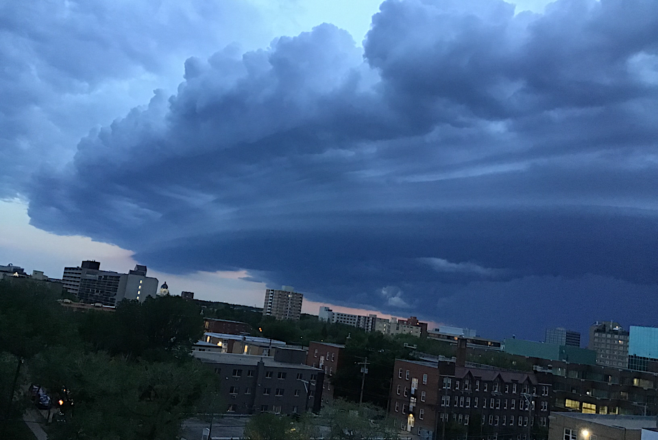
Forecasters are keeping an eye on the weather Thursday as more storms are expected to develop through the afternoon. This follows reports of severe weather and funnel clouds from Wednesday from the central part of the province.
Crawford Luke, meteorologist at Environment Canada, said the thunderstorm activity went all the way south.
“Basically we had thunderstorms that kind of stretched all the way from, I guess basically North Battleford all the way down to the Montana border in the south,” Luke. “So it was just kind of like a north to south line of storms. And yeah, there was a couple funnel cloud reports we have around Saskatoon that I'm aware of.”
Otherwise, there were “quite a few hail reports.” The largest was of golf ball-sized hail in the vicinity of the Battlefords, and Luke said they had “hail reports from east of Saskatoon up near Lloydminster. So it just seemed like everyone seemed to see a little bit of hail.”
As for potential severe weather today, Luke said today's chance is “kind of looking more, I guess, like Moose Jaw, Regina, and then maybe eastwards from there would be most likely areas.
“But yeah, we're definitely watching areas north of there too up to Saskatoon again for severe potential.”
The main threat today, he said, is wind and hail.
“It looks pretty good for that. So hail potentially up to 5 centimeters diameter, which would be about the size of a chicken egg. Wind gusts potentially gusting 110 kilometers an hour.”
While there had been tornado reports over the past week, Luke says there is a “lower chance, but a non- zero chance of a tornado potentially as well with storms today. So it could be kind of a similar repeat of yesterday, just a bit further east today, kind of east of Highway 11, east of Saskatoon, east of Moose Jaw is kind of looking like the sweet spot… Regina might get into it today, Yorkton, Melville, these sort of areas.”
As for what's fueling these conditions, Luke points to “basically just a lot of moisture feeding into the province from the southeast,” for several days now.
And so that is when we get that humidity ushered in, that really helps to create that unstable environment. And then once you mix that with some daytime heating from the sun coming up, that's really when we start to see these thunderstorm days in the summertime. So we've kind of been seeing that for the last few days.”
Luke says it looks like this pattern is going to continue for at least the next couple of days into Friday and Saturday for a lot of areas within the province.
As for next week into Canada Day, Luke says that by Sunday, it looks like things are starting to improve south of the Yellowhead, though north of the Yellowhead still looks kind of unsettled Sunday. Things should keep improving by Canada Day.
“I mean right now, still a few days out, but right now it looks promising, I'll say cautiously. But it looks like we'll have high pressure building in over the province, and so it should be a much lower chance of rain.”
He thinks It might be a “warm, sunny day across pretty much the entire province. Maybe even hot, coming up on 30 degrees there in some areas. So yeah, cautiously optimistic for a hot, sunny Canada Day, but definitely some unsettled weather to get through first.”
As for today, Luke urges people to stay tuned for Environment Canada watches and warnings. “I suspect we'll be seeing those come out pretty soon for Saskatchewan for today, and probably again tomorrow and Saturday.”


